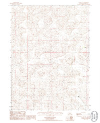
1986 Map of Rackett SE
USGS Topo · Published 1986About this map
Seeley Ranch and the small settlement of Carson anchor this mid-1980s look at the Nebraska Sandhills in Garden County. The landscape is defined by the complex topography of stabilized dunes, characterized by the intricate contouring of numerous depressions and rises typical of this region. This 1986 provisional map, compiled from 1982 aerial photography, documents the sparse human footprint in this part of the state. Outside of the primary ranching sites, the area is largely devoid of formal infrastructure, featuring scattered wells that support the local livestock operations. The map provides a clear record of the section lines and township boundaries, including the intersection of Township 19 North and Township 18 North, which illustrates the methodical division of these expansive grasslands for land management and grazing.
Find a feature on this map
6 named features on this map. Tap any name to fly to it.
Don’t see what you’re looking for? This feature index may not catch every label — zoom into the map to look around manually.
Map Details
Editions of this 1986 Rackett SE Map
This is the sole edition of this map. No revisions or reprints were ever made.
Other maps of this area

1897 · Ogallala
USGS Topo · 1:125,000

1900 · Chappell
USGS Topo · 1:125,000

1900 · Ogallala
USGS Topo · 1:125,000

1949 · Rackett
USGS Topo · 1:62,500

1950 · Velma
USGS Topo · 1:62,500

1951 · Rackett
USGS Topo · 1:62,500

1954 · Scottsbluff
USGS Topo · 1:250,000

1954 · North Platte
USGS Topo · 1:250,000

1956 · North Platte
USGS Topo · 1:250,000

1957 · North Platte
USGS Topo · 1:250,000