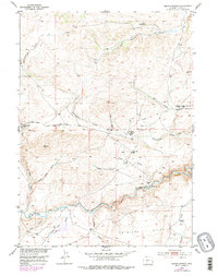
1953 Map of Radium Springs
USGS Topo · Published 1979About this map
The historic Oregon Trail cuts through this high desert landscape, marking a path of westward migration across the Antelope Hills. The map captures a region defined by early settlement and resource extraction, notably around the Lewiston (Site) and the namesake Radium Springs. Along the banks of the Sweetwater River and its various tributaries like Strawberry Creek, the survey reveals the legacy of local mining and ranching through features such as the Bullion Mine, Hidden Hand Mine, and Rate Homestead.
Find a feature on this map
27 named features on this map. Tap any name to fly to it.
Don’t see what you’re looking for? This feature index may not catch every label — zoom into the map to look around manually.
Map Details
Editions of this 1953 Radium Springs Map
3 editions found
Other maps of this area

1953 · Lewiston Lakes
USGS Topo · 1:24,000

1953 · Gravel Spring
USGS Topo · 1:24,000

1953 · Radium Springs
USGS Topo · 1:24,000

1953 · Schlichting Mountain
USGS Topo · 1:24,000

1953 · Atlantic City
USGS Topo · 1:24,000

1954 · Miners Delight
USGS Topo · 1:24,000

1955 · Lander
USGS Topo · 1:250,000

1958 · Lander
USGS Topo · 1:250,000
1958 · Schoettlin Mountain
USGS Topo · 1:24,000

1958 · Circle Bar Lake
USGS Topo · 1:24,000