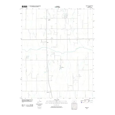
2010 Map of Rago
USGS Topo · Published 2010About this map
The Chikaskia River flows eastward across this Kansas landscape, serving as a central geographic feature between the small communities of Rago and Duquoin. This 2010 survey illustrates a highly organized agricultural grid defined by numerous section-line roads, including SE 110 St and SE 20 Ave. The pattern of development is concentrated along these transit corridors, with local landmarks such as the Rago Cemetery and Handkins Landing Strip providing essential points of reference for genealogists and local historians.
Find a feature on this map
32 named features on this map. Tap any name to fly to it.
Don’t see what you’re looking for? This feature index may not catch every label — zoom into the map to look around manually.
Map Details
Editions of this 2010 Rago Map
This is the sole edition of this map. No revisions or reprints were ever made.
Other maps of this area

1889 · Anthony
USGS Topo · 1:125,000

1889 · Cheney
USGS Topo · 1:125,000

1889 · Caldwell
USGS Topo · 1:125,000

1891 · Cheney
USGS Topo · 1:125,000

1891 · Anthony
USGS Topo · 1:125,000

1892 · Kingman
USGS Topo · 1:125,000

1893 · Caldwell
USGS Topo · 1:125,000

1894 · Kingman
USGS Topo · 1:125,000

1897 · Caldwell
USGS Topo · 1:125,000

1901 · Cheney
USGS Topo · 1:125,000