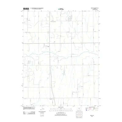
2012 Map of Rago
USGS Topo · Published 2012About this map
Rago and Duquoin serve as the primary anchors for this agricultural landscape in Harper County, where the transition from traditional rail-era settlements to modern aviation and land management is evident. The terrain is defined by a dense network of seasonal watercourses, including Rose Bud Cr and Copper Cr, which converge as they move through the township grid. For genealogists, the map specifically locates the Rago Cem and Duquoin Cem, providing precise coordinates for family research in these rural communities. The inclusion of the Handkins Landing Strip and Benningtons Lake highlights more contemporary adaptations of the land, while the rigid section-line roads like SE 120 St and S Berry Ave illustrate the enduring influence of the Public Land Survey System on Kansas's physical and social geography.
Find a feature on this map
41 named features on this map. Tap any name to fly to it.
Don’t see what you’re looking for? This feature index may not catch every label — zoom into the map to look around manually.
Map Details
Editions of this 2012 Rago Map
This is the sole edition of this map. No revisions or reprints were ever made.
Other maps of this area

1889 · Anthony
USGS Topo · 1:125,000

1889 · Cheney
USGS Topo · 1:125,000

1889 · Caldwell
USGS Topo · 1:125,000

1891 · Cheney
USGS Topo · 1:125,000

1891 · Anthony
USGS Topo · 1:125,000

1892 · Kingman
USGS Topo · 1:125,000

1893 · Caldwell
USGS Topo · 1:125,000

1894 · Kingman
USGS Topo · 1:125,000

1897 · Caldwell
USGS Topo · 1:125,000

1901 · Cheney
USGS Topo · 1:125,000