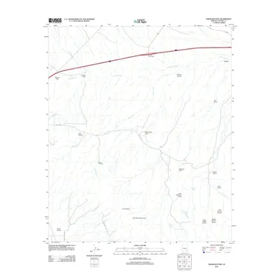
2011 Map of Railroad Pass
USGS Topo · Published 2011About this map
The high desert corridor of Cochise County is defined by the critical transit route through Railroad Pass, where the landscape transitions between the high peaks of the Dos Cabezas Mountains and the valley floor. Historically a vital path for westward expansion, this 2011 survey shows the modern alignment of Interstate 10 and the Southern Pacific tracks passing near the settlement of Luzena. The terrain is characterized by a complex network of drainage systems like Railroad Wash and Smith Wash, which flow from the rugged canyons of the surrounding mountains. Notable landmarks including Camels Back and Misenhimer Draw provide geographical context for this arid region, while the Flying W Ranch indicates the long-standing ranching presence in the Arizona desert.
Find a feature on this map
1 named feature on this map. Tap any name to fly to it.
Don’t see what you’re looking for? This feature index may not catch every label — zoom into the map to look around manually.
Map Details
Editions of this 2011 Railroad Pass Map
This is the sole edition of this map. No revisions or reprints were ever made.
Other maps of this area

1922 · Willcox
USGS Topo · 1:125,000

1943 · Dos Cabezas
USGS Topo · 1:62,500

1943 · Willcox
USGS Topo · 1:62,500

1943 · Cochise
USGS Topo · 1:62,500

1944 · Fisher Hills
USGS Topo · 1:62,500

1954 · Silver City
USGS Topo · 1:250,000

1957 · Dos Cabezas
USGS Topo · 1:62,500

1957 · Luzena
USGS Topo · 1:62,500

1958 · Silver City
USGS Topo · 1:250,000

1958 · Willcox
USGS Topo · 1:62,500