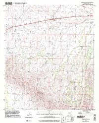
1996 Map of Railroad Pass
USGS Topo · Published 2002About this map
Railroad Pass serves as the focal point of this 1990s-era topographic study, where the transportation corridor of the Railroad and Pipeline networks bisects the landscape of Cochise County. The terrain transitions from the alluvial fans of Railroad Wash and Hay Flat Draw in the north to the formidable slopes of the Dos Cabezas Mountains in the south. High-elevation landmarks like Camels Back overlook a network of deep-cut drainage systems, including Zelita Canyon and Smith Canyon.
Find a feature on this map
33 named features on this map. Tap any name to fly to it.
Don’t see what you’re looking for? This feature index may not catch every label — zoom into the map to look around manually.
Map Details
Editions of this 1996 Railroad Pass Map
This is the sole edition of this map. No revisions or reprints were ever made.
Other maps of this area

1922 · Willcox
USGS Topo · 1:125,000

1943 · Dos Cabezas
USGS Topo · 1:62,500

1943 · Willcox
USGS Topo · 1:62,500

1943 · Cochise
USGS Topo · 1:62,500

1944 · Fisher Hills
USGS Topo · 1:62,500

1954 · Silver City
USGS Topo · 1:250,000

1957 · Dos Cabezas
USGS Topo · 1:62,500

1957 · Luzena
USGS Topo · 1:62,500

1958 · Silver City
USGS Topo · 1:250,000

1958 · Willcox
USGS Topo · 1:62,500