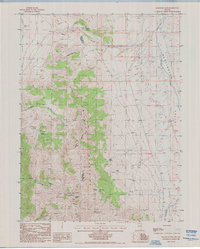
1985 Map of Railroad Pass
USGS Topo · Published 1986About this map
The high ridges of the Diamond Mountains dominate this mid-1980s topographical survey, marking a stark physical and political divide between Eureka Co and White Pine Co. This high-altitude landscape is defined by resource extraction and sparse water sources, centered around the prominent Diamond Peak and the namesake Railroad Pass. Evidence of industrial activity is scattered throughout the southern range, including an Open Pit Mine, a Mine Tunnel Ent, and several unnamed prospects.
Find a feature on this map
23 named features on this map. Tap any name to fly to it.
Don’t see what you’re looking for? This feature index may not catch every label — zoom into the map to look around manually.
Map Details
Editions of this 1985 Railroad Pass Map
This is the sole edition of this map. No revisions or reprints were ever made.
Other maps of this area

1934 · Jiggs
USGS Topo · 1:125,000

1937 · Jiggs
USGS Topo · 1:125,000

1955 · Elko
USGS Topo · 1:250,000

1956 · Ely
USGS Topo · 1:250,000

1957 · Diamond Springs
USGS Topo · 1:62,500

1957 · Cold Creek Ranch
USGS Topo · 1:62,500

1958 · Elko
USGS Topo · 1:250,000

1959 · Ely
USGS Topo · 1:250,000

1959 · Railroad Pass
USGS Topo · 1:62,500

1959 · Sherman Mtn
USGS Topo · 1:62,500