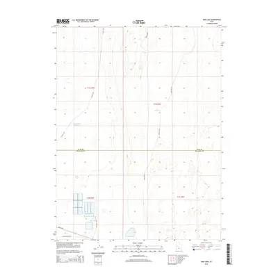
2014 Map of Rain Lake
USGS Topo · Published 2014About this map
The IPP Power Plant anchors the southern portion of this landscape near the border of Millard and Juab counties, representing a significant industrial footprint in an otherwise sparse desert environment. Industrial and energy infrastructure is further evidenced by Energy Corridor Rd and Brush Hwy, which facilitate access to this isolated technical hub. To the north, the terrain is defined by low-lying basins and water management features including Rain Lake, CCC Reservoir, and N Sugarville Reservoir. These seasonal or managed water bodies are connected by a network of utilitarian roads such as Golden Hwy, Sand Dune Rd, and the uniquely named Sweats Cow Rd. The map illustrates a high-desert region shaped by modern energy production and the careful control of limited water resources.
Find a feature on this map
14 named features on this map. Tap any name to fly to it.
Don’t see what you’re looking for? This feature index may not catch every label — zoom into the map to look around manually.
Map Details
Editions of this 2014 Rain Lake Map
This is the sole edition of this map. No revisions or reprints were ever made.
Other maps of this area

1885 · Sevier Desert
USGS Topo · 1:250,000

1951 · Oak City
USGS Topo · 1:62,500

1953 · Delta
USGS Topo · 1:250,000

1958 · Delta
USGS Topo · 1:250,000

1962 · Delta
USGS Topo · 1:250,000

1962 · Lynndyl
USGS Topo · 1:62,500

1962 · Delta
USGS Topo · 1:62,500

1971 · Baker Hot Springs
USGS Topo · 1:24,000

1971 · Rain Lake
USGS Topo · 1:24,000

1971 · Crater Bench Reservoir
USGS Topo · 1:24,000