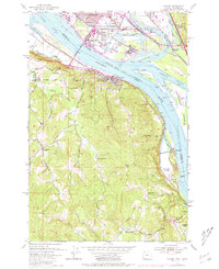
1953 Map of Rainier
USGS Topo · Published 1981About this map
The industrial corridor of the Columbia River dominates this mid-century landscape, where the bustling Port of Longview and massive Sawmill facilities on the Washington side contrast with the steep, wooded hills of Columbia County, Oregon. On the northern bank, the U S Naval Reserve Training Center and Kelso Municipal Airport mark the post-war development of the region, while the Interstate Toll Bridge links the economies of Longview and Rainier.
Find a feature on this map
55 named features on this map. Tap any name to fly to it.
Don’t see what you’re looking for? This feature index may not catch every label — zoom into the map to look around manually.
Map Details
Editions of this 1953 Rainier Map
4 editions found

Other maps of this area

1919 · Mayger
USGS Topo · 1:62,500

1921 · Kalama
USGS Topo · 1:62,500

1922 · St. Helens
USGS Topo · 1:62,500

1940 · Vernonia
USGS Topo · 1:62,500

1941 · St Helens
USGS Topo · 1:62,500

1941 · Clatskanie
USGS Topo · 1:62,500

1943 · Vernonia
USGS Topo · 1:62,500

1943 · St Helens
USGS Topo · 1:62,500

1948 · Vancouver
USGS Topo · 1:250,000

1950 · Vancouver
USGS Topo · 1:250,000