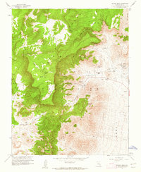
1961 Map of Rainier Mesa
USGS Topo · Published 1962About this map
Nevada Test Site Area 12 and Area 14 dominate this 1961 survey, revealing a landscape defined by the early Cold War atomic testing program. Mapped in cooperation with the Atomic Energy Commission, the terrain is marked by specialized infrastructure, including a Radioactive Waste Dump, a High Explosive Test Area, and High Explosive Storage. Amidst the high-tech testing grounds, traditional desert landmarks remain, such as Whiterock Spring and Captain Jack Spring, which contrast with the modern industrial footprint of numerous Drill Holes and Vents.
Find a feature on this map
29 named features on this map. Tap any name to fly to it.
Don’t see what you’re looking for? This feature index may not catch every label — zoom into the map to look around manually.
Map Details
Editions of this 1961 Rainier Mesa Map
2 editions found
Other maps of this area

1908 · Kawich
USGS Topo · 1:250,000

1942 · Wheelbarrow Peak
USGS Topo · 1:125,000

1952 · Tippipah Spring
USGS Topo · 1:62,500

1952 · Timber Mountain
USGS Topo · 1:62,500

1952 · Wheelbarrow Peak
USGS Topo · 1:62,500

1952 · Silent Canyon
USGS Topo · 1:62,500

1954 · Goldfield
USGS Topo · 1:250,000

1955 · Goldfield
USGS Topo · 1:250,000

1958 · Goldfield
USGS Topo · 1:250,000
1960 · Yucca Flat
USGS Topo · 1:24,000