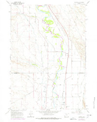
1967 Map of Rairden
USGS Topo · Published 1978About this map
The Bighorn River carves a fertile corridor through this high-desert basin, where complex irrigation networks like the Bighorn Canal, Fritz Canal, and Lower Hanover Canal define the settlement patterns. Small stations and trackside communities such as Rairden, Eccles, and Durkee sit along the Burlington Northern railroad, reflecting the era's reliance on rail for agricultural and mineral transport. The landscape is marked by the transition between the riparian valley and the arid uplands, where several Oil Wells and a Gravel Pit indicate the local extractive economy. Natural drainage from Alamo Creek, Fivemile Creek, and Sirmile Creek provides the topographical framework for the boundary between Big Horn and Washakie counties.
Find a feature on this map
16 named features on this map. Tap any name to fly to it.
Don’t see what you’re looking for? This feature index may not catch every label — zoom into the map to look around manually.
Map Details
Editions of this 1967 Rairden Map
2 editions found
Other maps of this area

1951 · Schuster Flats NE
USGS Topo · 1:24,000

1951 · Schuster Flats SE
USGS Topo · 1:24,000

1955 · Cody
USGS Topo · 1:250,000

1955 · Sheridan
USGS Topo · 1:250,000

1958 · Cody
USGS Topo · 1:250,000

1958 · Sheridan
USGS Topo · 1:250,000

1960 · Manderson
USGS Topo · 1:24,000

1960 · Manderson SE
USGS Topo · 1:24,000

1962 · Sheridan
USGS Topo · 1:250,000

1962 · Cody
USGS Topo · 1:250,000