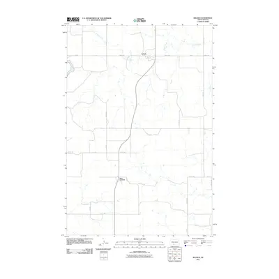
2011 Map of Raleigh
USGS Topo · Published 2011About this map
Raleigh serves as the primary hub of this North Dakota landscape, situated near the winding path of Dogtooth Creek. The settlement pattern reflects the traditional Great Plains township and range grid, with a network of local roads such as 45th Ave SW and 73rd St providing access to the surrounding farmsteads. Further south, the community of Saint Gertrude appears as a distinct waypoint along the north-south transit corridor. This 2011 survey captures the area's rural character, where the topography is defined more by the drainage of Dogtooth Creek than by major urban development. The layout of section roads like 80th St SW and 43rd Ave SW illustrates the persistent structure of land division that has shaped Grant County for generations.
Find a feature on this map
23 named features on this map. Tap any name to fly to it.
Don’t see what you’re looking for? This feature index may not catch every label — zoom into the map to look around manually.
Map Details
Editions of this 2011 Raleigh Map
This is the sole edition of this map. No revisions or reprints were ever made.
Other maps of this area

1954 · Bismarck
USGS Topo · 1:250,000

1958 · Bismarck
USGS Topo · 1:250,000

1971 · Shields
USGS Topo · 1:24,000

1980 · Brisbane
USGS Topo · 1:24,000

1980 · Bell Coulee West
USGS Topo · 1:24,000

1980 · Freda
USGS Topo · 1:24,000

1980 · Lark
USGS Topo · 1:24,000

1980 · Bell Coulee East
USGS Topo · 1:24,000

1980 · Dogtooth Buttes
USGS Topo · 1:24,000

1980 · Raleigh
USGS Topo · 1:24,000