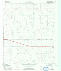
1967 Map of Ralls NE
USGS Topo · Published 1982About this map
Ralls and Crosbyton anchor this western Crosby County landscape, connected by a prominent four-lane highway that bisects the central plains. The terrain is characterized by numerous small depressions and ephemeral water bodies, punctuated by isolated industrial and agricultural landmarks. Rural education is represented by the Fairview Sch, situated north of the main thoroughfare. The presence of a Landing Strip and a Substation near the settlements indicates the infrastructure supporting this High Plains region during the mid-1960s. Aside from the primary towns, the map reveals a scattering of wells and a Gravel Pit, suggesting the importance of resource extraction and water management in this agricultural environment. The survey also notes Ralls RM 1, providing a point of reference for local surveyors and land researchers.
Find a feature on this map
7 named features on this map. Tap any name to fly to it.
Don’t see what you’re looking for? This feature index may not catch every label — zoom into the map to look around manually.
Map Details
Editions of this 1967 Ralls NE Map
2 editions found
Other maps of this area

1954 · Lubbock
USGS Topo · 1:250,000

1965 · Cone
USGS Topo · 1:24,000

1965 · Floydada SE
USGS Topo · 1:24,000

1966 · Crosbyton
USGS Topo · 1:24,000

1966 · Mount Blanco
USGS Topo · 1:24,000

1966 · Collett Springs
USGS Topo · 1:24,000

1967 · Ralls SE
USGS Topo · 1:24,000

1967 · Ralls NE
USGS Topo · 1:24,000

1967 · Ralls
USGS Topo · 1:24,000

1967 · Savage
USGS Topo · 1:24,000