
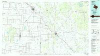
1967 Map of Ralls SE
USGS Topo · Published 1968About this map
Owens sits at the heart of this agricultural landscape in Crosby County, situated on the vast, flat expanse of the Llano Estacado. Surveyed in the late 1960s, the map reveals a highly developed system of groundwater extraction, with dozens of irrigation wells dotting the grid-patterned terrain. This infrastructure was essential for the region's intensive cotton and grain production, marking a period when mechanized irrigation transformed West Texas farming. Near the settlement, a Water Tank and a dedicated Landing Strip serve the local community, reflecting the necessity of aerial crop dusting and localized water storage in this semi-arid environment. The sharp contrast of the Caprock Escarpment begins to emerge in the southeastern corner, where the level plains give way to the broken, deeply eroded draws and canyons that define the edge of the High Plains.
Find a feature on this map
4 named features on this map. Tap any name to fly to it.
Don’t see what you’re looking for? This feature index may not catch every label — zoom into the map to look around manually.
Map Details
Editions of this 1967 Ralls SE Map
This is the sole edition of this map. No revisions or reprints were ever made.
Other maps of this area

1954 · Lubbock
USGS Topo · 1:250,000

1966 · Cap Rock
USGS Topo · 1:24,000

1966 · Crosbyton
USGS Topo · 1:24,000

1966 · Kalgary
USGS Topo · 1:24,000

1966 · Collett Springs
USGS Topo · 1:24,000

1966 · Canyon Valley
USGS Topo · 1:24,000

1967 · Ralls NE
USGS Topo · 1:24,000

1967 · Ralls
USGS Topo · 1:24,000

1967 · Savage
USGS Topo · 1:24,000
1986 · Slaton
USGS Topo · 1:100,000