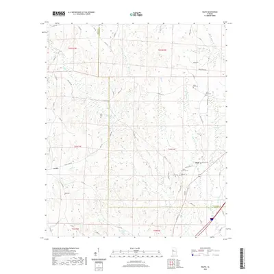
2020 Map of Ralph
USGS Topo · Published 2020About this map
The boundary between Greene County and Tuscaloosa County divides this rural landscape, where the settlements of Ralph and Snoddy serve as the primary anchors. This area is heavily defined by a high concentration of cemeteries and family-associated landmarks, including Old Shiloh Cem, Wesley Chapel Cem, and Beulah Cem, which offer significant value for genealogical research. The topography is intricately carved by numerous small watercourses like Little Buck Cr, Taylor Cr, and McCracken Cr, which flow through the undulating terrain toward Reed Swamp. This network of creeks and branches dictated the winding paths of local thoroughfares such as Gainesville Rd and Pinson Branch Rd. The southeastern corner shows more modern infrastructure development near the intersection of Ralph Loop Rd and major county roads, while much of the quadrangle retains its traditional rural character, centered around older community hubs like Mount Herman Cem.
Find a feature on this map
70 named features on this map. Tap any name to fly to it.
Don’t see what you’re looking for? This feature index may not catch every label — zoom into the map to look around manually.
Map Details
Editions of this 2020 Ralph Map
This is the sole edition of this map. No revisions or reprints were ever made.
Other maps of this area

1924 · Tuscaloosa
USGS Topo · 1:62,500

1926 · Tuscaloosa
USGS Topo · 1:62,500

1927 · Eutaw
USGS Topo · 1:48,000

1931 · Eutaw
USGS Topo · 1:62,500

1953 · Montgomery
USGS Topo · 1:250,000

1953 · Birmingham
USGS Topo · 1:250,000

1956 · Birmingham
USGS Topo · 1:250,000

1956 · Montgomery
USGS Topo · 1:250,000

1957 · Birmingham
USGS Topo · 1:250,000

1957 · Montgomery
USGS Topo · 1:250,000