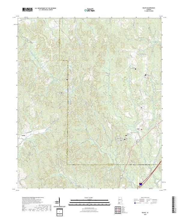
2024 Map of Ralph
USGS Topo · Published 2024About this map
Small rural communities and a high concentration of ancestral burial grounds define this landscape along the border of Greene and Tuscaloosa Counties. The settlement of Ralph serves as a local focal point near the eastern edge, while Snoddy occupies the western reaches. This area is characterized by its intricate drainage systems, where Taylor Creek and Brush Creek carve through the terrain, eventually feeding into the larger wetland environment of Reed Swamp.
Find a feature on this map
79 named features on this map. Tap any name to fly to it.
Don’t see what you’re looking for? This feature index may not catch every label — zoom into the map to look around manually.
Map Details
Editions of this 2024 Ralph Map
This is the sole edition of this map. No revisions or reprints were ever made.
Other maps of this area

1924 · Tuscaloosa
USGS Topo · 1:62,500

1926 · Tuscaloosa
USGS Topo · 1:62,500

1927 · Eutaw
USGS Topo · 1:48,000

1931 · Eutaw
USGS Topo · 1:62,500

1953 · Montgomery
USGS Topo · 1:250,000

1953 · Birmingham
USGS Topo · 1:250,000

1956 · Birmingham
USGS Topo · 1:250,000

1956 · Montgomery
USGS Topo · 1:250,000

1957 · Birmingham
USGS Topo · 1:250,000

1957 · Montgomery
USGS Topo · 1:250,000