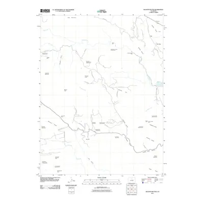
2011 Map of Ralston Buttes
USGS Topo · Published 2011About this map
The Shewartzwalder Mine and a dense concentration of pegmatite operations define the industrial character of this landscape in the eastern foothills of the Front Range. Surveyed in the early 21st century, the terrain is marked by numerous family-named extractive sites, including the Ramstetter Ranch Mine, Fred Pierce Ranch Mine, and the Ladwig-Grosso Pegmatite Mine. These labels provide a clear picture of how private ranch lands and mining claims integrated throughout the winding drainages of Crawford Gulch and Tucker Gulch. To the north, Ralston Creek flows toward the Ralston Reservoir, while prominent landmarks like Grannys Head and Belcher Hill dominate the topography. The presence of specialized sites like the Hoffmeister Uranium Prospect Mine and the Elledge Beryl Prospect Mine highlights the varied mineral history that has long drawn exploration to these gulches and canyons near Golden Gate Canyon.
Find a feature on this map
75 named features on this map. Tap any name to fly to it.
Don’t see what you’re looking for? This feature index may not catch every label — zoom into the map to look around manually.
Map Details
Editions of this 2011 Ralston Buttes Map
This is the sole edition of this map. No revisions or reprints were ever made.
Other maps of this area

1899 · West Denver
USGS Topo · 1:125,000

1906 · Blackhawk
USGS Topo · 1:62,500

1938 · Morrison
USGS Topo · 1:24,000

1939 · Golden
USGS Topo · 1:24,000

1942 · Eldorado Springs
USGS Topo · 1:24,000

1942 · Morrison
USGS Topo · 1:31,680

1942 · Golden
USGS Topo · 1:31,680

1942 · Louisville
USGS Topo · 1:31,680

1942 · Tungsten
USGS Topo · 1:24,000

1942 · Black Hawk
USGS Topo · 1:24,000