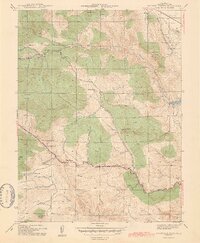
1944 Map of Ralston Buttes
USGS Topo · Published 1944About this map
Ralston Buttes and the surrounding terrain of the Front Range appear here as they were surveyed in the early 1940s by the Work Projects Administration. The landscape is defined by its dramatic elevation changes, with Centralia Mountain and Mt Tom rising above a complex network of drainages. The Denver and Salt Lake RR cuts through the northeast corner of the sheet, serving industrial points like Fireclay and the Arena Siding.
Find a feature on this map
32 named features on this map. Tap any name to fly to it.
Don’t see what you’re looking for? This feature index may not catch every label — zoom into the map to look around manually.
Map Details
Editions of this 1944 Ralston Buttes Map
2 editions found
Other maps of this area

1899 · West Denver
USGS Topo · 1:125,000

1906 · Blackhawk
USGS Topo · 1:62,500

1938 · Morrison
USGS Topo · 1:24,000

1939 · Golden
USGS Topo · 1:24,000

1942 · Eldorado Springs
USGS Topo · 1:24,000

1942 · Morrison
USGS Topo · 1:31,680

1942 · Golden
USGS Topo · 1:31,680

1942 · Louisville
USGS Topo · 1:31,680

1942 · Tungsten
USGS Topo · 1:24,000

1942 · Black Hawk
USGS Topo · 1:24,000