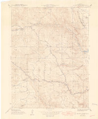
1948 Map of Ralston Buttes
USGS Topo · Published 1948About this map
The rugged foothills of the Front Range are captured here during a period of transition in the late 1940s. Distinctive landmarks like Ralston Buttes and Mt Tom overlook a landscape carved by Ralston Creek and Van Bibber Creek. This area, mapped in cooperation with the City and County of Denver, reflects the vital intersection of ranching and water management, evidenced by the Ralston Res and several family-named ranching operations like the Ralston Creek Ranch and Centennial Ranch.
Find a feature on this map
33 named features on this map. Tap any name to fly to it.
Don’t see what you’re looking for? This feature index may not catch every label — zoom into the map to look around manually.
Map Details
Editions of this 1948 Ralston Buttes Map
This is the sole edition of this map. No revisions or reprints were ever made.
Other maps of this area

1899 · West Denver
USGS Topo · 1:125,000

1906 · Blackhawk
USGS Topo · 1:62,500

1938 · Morrison
USGS Topo · 1:24,000

1939 · Golden
USGS Topo · 1:24,000

1942 · Eldorado Springs
USGS Topo · 1:24,000

1942 · Morrison
USGS Topo · 1:31,680

1942 · Golden
USGS Topo · 1:31,680

1942 · Louisville
USGS Topo · 1:31,680

1942 · Tungsten
USGS Topo · 1:24,000

1942 · Black Hawk
USGS Topo · 1:24,000