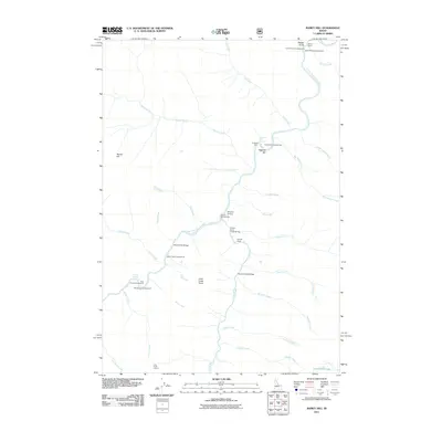
2011 Map of Ramey Hill
USGS Topo · Published 2011About this map
The Middle Fork Salmon River carves a deep path through this backcountry landscape, serving as the central artery for a series of remote outposts and recreational sites. Settlement patterns here are defined by isolated holdings such as Tappen Ranch and Simplot Ranch, which are supported by the Simplot Airstrip. This area is notable for its geothermal features, including Hospital Hot Spring and Cox Hot Springs, which have long drawn visitors to the river's edge. High-elevation vantage points like Ramey Hill and the Loon Creek Lookout provide oversight of a vast network of drainages, from Cub Creek in the north to Falconberry Lake at the southern margin. The presence of numerous designated sites like Hospital Bar Campground and Island Campground indicates the enduring importance of the river corridor for seasonal access and wilderness transit.
Find a feature on this map
44 named features on this map. Tap any name to fly to it.
Don’t see what you’re looking for? This feature index may not catch every label — zoom into the map to look around manually.
Map Details
Editions of this 2011 Ramey Hill Map
This is the sole edition of this map. No revisions or reprints were ever made.
Other maps of this area

1930 · Casto
USGS Topo · 1:125,000

1957 · Challis
USGS Topo · 1:250,000

1960 · Challis
USGS Topo · 1:250,000

1962 · Bear Creek Point
USGS Topo · 1:24,000

1962 · Norton Ridge
USGS Topo · 1:24,000

1962 · Shellrock Peak
USGS Topo · 1:24,000

1962 · Ramey Hill
USGS Topo · 1:24,000

1963 · Challis
USGS Topo · 1:250,000

1963 · Rock Creek
USGS Topo · 1:24,000
1963 · Aparejo Point
USGS Topo · 1:24,000