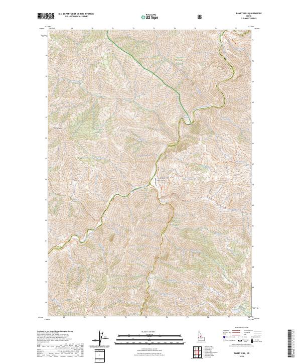
2024 Map of Ramey Hill
USGS Topo · Published 2024About this map
The Middle Fork Salmon River carves through the center of this remote Idaho landscape, serving as a corridor for backcountry aviation and travel within the Frank Church-River of No Return Wilderness. This 2024 survey details the intersection of the Boise National Forest, Challis National Forest, and Salmon National Forest, where the river's flow dictates the geography of named bars and riparian landmarks. Accessibility is defined by isolated features like the Lower Loon Creek Airport and the Middle Fork Trl, which provide the only managed points of entry into these protected lands. Geologic activity is noted at Hospital Hot Springs and other Hot Springs along the riverbanks, while the surrounding drainage basin is fed by numerous named tributaries including Loon Creek and Norton Creek. This mapping shows the persistent character of one of the nation's most preserved wilderness regions.
Find a feature on this map
56 named features on this map. Tap any name to fly to it.
Don’t see what you’re looking for? This feature index may not catch every label — zoom into the map to look around manually.
Map Details
Editions of this 2024 Ramey Hill Map
This is the sole edition of this map. No revisions or reprints were ever made.
Other maps of this area

1930 · Casto
USGS Topo · 1:125,000

1957 · Challis
USGS Topo · 1:250,000

1960 · Challis
USGS Topo · 1:250,000

1962 · Bear Creek Point
USGS Topo · 1:24,000

1962 · Norton Ridge
USGS Topo · 1:24,000

1962 · Shellrock Peak
USGS Topo · 1:24,000

1962 · Ramey Hill
USGS Topo · 1:24,000

1963 · Challis
USGS Topo · 1:250,000

1963 · Rock Creek
USGS Topo · 1:24,000
1963 · Aparejo Point
USGS Topo · 1:24,000