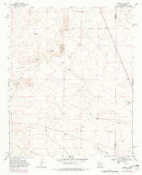
1967 Map of Ramon
USGS Topo · Published 1982About this map
Simpson Ranch and Merritt Ranch occupy the high plains of the Lincoln Co De Baca Co line in this late-1960s survey. The landscape is defined by its water management systems, essential for ranching in this arid environment, featuring a network of named catchment points like Schoolhouse Tank, Bethell Tank, and Burnt Tank. The topography is marked by the prominent Red Bluffs and drainage systems including Dipping Vat Draw and Loco Draw.
Find a feature on this map
17 named features on this map. Tap any name to fly to it.
Don’t see what you’re looking for? This feature index may not catch every label — zoom into the map to look around manually.
Map Details
Editions of this 1967 Ramon Map
2 editions found
Other maps of this area

1954 · Fort Sumner
USGS Topo · 1:250,000

1958 · Fort Sumner
USGS Topo · 1:250,000

1967 · Wire Lake
USGS Topo · 1:24,000

1967 · Ramon
USGS Topo · 1:24,000

1967 · Ramon SW
USGS Topo · 1:24,000

1967 · Wright Ranch
USGS Topo · 1:24,000

1979 · Fort Sumner
USGS Topo · 1:100,000

1980 · Corona
USGS Topo · 1:100,000

1981 · Loco Draw
USGS Topo · 1:24,000

1981 · Cowboy Mesa NE
USGS Topo · 1:24,000