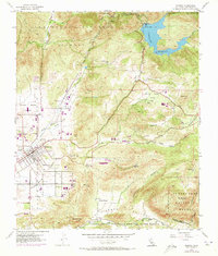
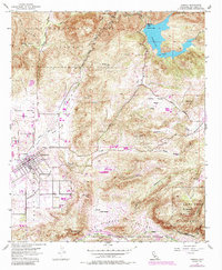
1955 Map of Ramona
USGS Topo · Published 1973About this map
The town of Ramona serves as the focal point for this mid-century survey of the Santa Maria Valley, where agriculture and ranching meet the rising foothills of the Cleveland National Forest. The map documents a landscape in transition, where established locations like the Bassett Ranch and the Goose Valley Ranger Sta sit alongside mid-century infrastructure like the Sutherland Reservoir and its associated Gaging Sta. The presence of the Union High School and a Cem within the town site provides essential anchor points for genealogists researching family ties in the valley.
Find a feature on this map
44 named features on this map. Tap any name to fly to it.
Don’t see what you’re looking for? This feature index may not catch every label — zoom into the map to look around manually.
Map Details
Editions of this 1955 Ramona Map
6 editions found
Other maps of this area

1893 · El Cajon
USGS Topo · 1:62,500

1901 · Elcajon
USGS Topo · 1:62,500

1903 · Cuyamaca
USGS Topo · 1:125,000

1903 · Elcajon
USGS Topo · 1:62,500

1903 · Ramona
USGS Topo · 1:125,000

1904 · Southern California Sheet No. 2
USGS Topo · 1:250,000

1939 · El Cajon
USGS Topo · 1:62,500

1939 · Santa Ysabel
USGS Topo · 1:62,500

1942 · El Cajon
USGS Topo · 1:62,500

1942 · Ramona
USGS Topo · 1:62,500