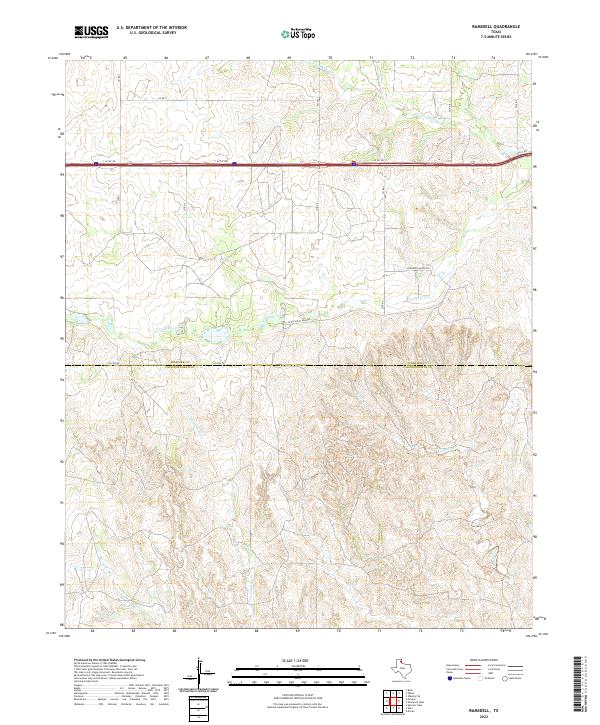
2022 Map of Ramsdell
USGS Topo · Published 2022About this map
The northern edge of the Texas Panhandle is defined by the sharp transition between the upland plains and the drainage basins of the Red River watershed. This survey of the landscape along the border of Wheeler and Collingsworth counties reveals a terrain heavily dissected by seasonal watercourses. The prominent S Long Dry Cr and N Long Dry Cr carve through the northern half of the map, while the headwaters of Sandy Creek and Richardson Cr dominate the south. These creek beds and their surrounding draws dictate the placement of local infrastructure, such as Co Rd South Dakota and McDowell Ranch Rd, which follow the natural contours of the land. The map illustrates how ranching interests and geography have preserved a sparse settlement pattern even into the modern era, with long stretches of rural routes like Fm 453 connecting isolated ranch properties across the divide.
Find a feature on this map
18 named features on this map. Tap any name to fly to it.
Don’t see what you’re looking for? This feature index may not catch every label — zoom into the map to look around manually.
Map Details
Editions of this 2022 Ramsdell Map
This is the sole edition of this map. No revisions or reprints were ever made.
Other maps of this area

1954 · Amarillo
USGS Topo · 1:250,000

1958 · Amarillo
USGS Topo · 1:250,000

1959 · Spencer Lake
USGS Topo · 1:24,000

1962 · Back
USGS Topo · 1:24,000

1962 · Wheeler SE
USGS Topo · 1:24,000

1962 · Pakan
USGS Topo · 1:24,000

1963 · Ramsdell
USGS Topo · 1:24,000

1963 · Shamrock West
USGS Topo · 1:24,000

1963 · McLean
USGS Topo · 1:24,000
1964 · Abra
USGS Topo · 1:24,000