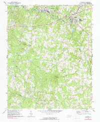
1968 Map of Ramseur
USGS Topo · Published 1990About this map
The Deep River winds through the northern portion of this landscape, anchoring the industrial and civic life of Ramseur and Franklinville. Along the river's path, specialized infrastructure like the Filtration Plant and Sewage Disposal facility support these growing communities, while the Southern railroad line follows the water to facilitate local commerce. The surrounding terrain is defined by a dense network of small family-centered landmarks and rural institutions.
Find a feature on this map
34 named features on this map. Tap any name to fly to it.
Don’t see what you’re looking for? This feature index may not catch every label — zoom into the map to look around manually.
Map Details
Editions of this 1968 Ramseur Map
2 editions found
Other maps of this area

1953 · Raleigh
USGS Topo · 1:250,000

1954 · Raleigh
USGS Topo · 1:250,000

1957 · Asheboro
USGS Topo · 1:62,500

1968 · Ramseur
USGS Topo · 1:24,000

1968 · Coleridge
USGS Topo · 1:24,000

1968 · Erect
USGS Topo · 1:24,000

1968 · Bennett
USGS Topo · 1:24,000

1970 · Randleman
USGS Topo · 1:24,000

1970 · Asheboro
USGS Topo · 1:24,000

1973 · Seagrove
USGS Topo · 1:24,000