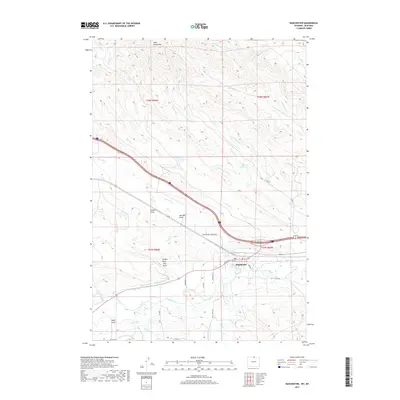
2017 Map of Ranchester
USGS Topo · Published 2017About this map
Ranchester sits at the confluence of the Tongue River and Wolf Cr, serving as a focal point for the complex irrigation and drainage systems that define this northern Wyoming landscape. The presence of numerous named waterways such as Mikado Ditch, Hanover Ditch, Oz Ditch, and York Ditch highlights a long-standing reliance on managed water for ranching and agriculture in the valley. To the north, the terrain rises into the Wolf Mountains, marked by deep drainage features including Gwinn Draw, Jack Bill Draw, and Stoops Draw. This 2017 survey shows the modern transportation network, from the residential streets of Dayton St and Hardin St to the larger Ranchester-Five Mile Rd, illustrating how the town has integrated with the natural topography of the river basin.
Find a feature on this map
45 named features on this map. Tap any name to fly to it.
Don’t see what you’re looking for? This feature index may not catch every label — zoom into the map to look around manually.
Map Details
Editions of this 2017 Ranchester Map
This is the sole edition of this map. No revisions or reprints were ever made.
Other maps of this area

1894 · Rosebud
USGS Topo · 1:125,000

1895 · Dayton
USGS Topo · 1:125,000

1901 · Rosebud
USGS Topo · 1:125,000

1901 · Dayton
USGS Topo · 1:125,000

1954 · Hardin
USGS Topo · 1:250,000

1955 · Sheridan
USGS Topo · 1:250,000

1957 · Hardin
USGS Topo · 1:250,000

1958 · Hardin
USGS Topo · 1:250,000

1958 · Sheridan
USGS Topo · 1:250,000

1962 · Sheridan
USGS Topo · 1:250,000