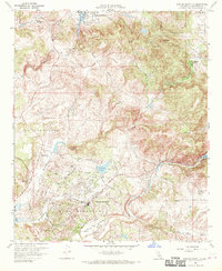
1968 Map of Rancho Santa Fe
USGS Topo · Published 1970About this map
Rancho Santa Fe and the surrounding coastal canyons are documented here in the late 1960s, a period of transition for this inland San Diego County landscape. The map highlights established land grants and historic estates like Rancho de los Quiotes and Osuna, reflecting the region's deep agricultural and ranching roots. To the west, the settlement of Olivenhain includes the Olivenhain Cemetery, while the northern hills are marked by prominent peaks such as Double Peak and Cerro de las Posas.
Find a feature on this map
37 named features on this map. Tap any name to fly to it.
Don’t see what you’re looking for? This feature index may not catch every label — zoom into the map to look around manually.
Map Details
Editions of this 1968 Rancho Santa Fe Map
4 editions found
Other maps of this area

1893 · Oceanside
USGS Topo · 1:62,500

1893 · Escondido
USGS Topo · 1:62,500

1898 · Oceanside
USGS Topo · 1:62,500

1901 · Escondido
USGS Topo · 1:62,500

1901 · Oceanside
USGS Topo · 1:62,500

1901 · San Luis Rey
USGS Topo · 1:125,000

1903 · La Jolla
USGS Topo · 1:62,500

1904 · Southern California Sheet No. 2
USGS Topo · 1:250,000

1930 · La Jolla
USGS Topo · 1:62,500

1942 · Poway Valley
USGS Topo · 1:31,680