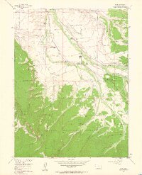
1956 Map of Rand
USGS Topo · Published 1963About this map
Ranching and water management define this high-altitude landscape where the Illinois River flows through North Park. The small settlement of Rand serves as a central hub, accompanied by the Rand Sch and Rand Cem. The map reveals an intricate network of irrigation canals essential for local agriculture, including the Peabody Ditch, Sutton Ditch, and Garland Ditch. Several family-held properties such as the Stephens Brothers Ranch, Fuqua Ranch, and Howard Place are scattered across the valley floor. To the south and west, the terrain rises into the timbered slopes of the Routt National Forest and the prominent Green Ridge. A curious piece of local social history is found at the Racetrack (Aband) near the Old Homestead, suggesting a former gathering place for the community during earlier decades of the twentieth century.
Find a feature on this map
89 named features on this map. Tap any name to fly to it.
Don’t see what you’re looking for? This feature index may not catch every label — zoom into the map to look around manually.
Map Details
Editions of this 1956 Rand Map
4 editions found

Other maps of this area

1954 · Craig
USGS Topo · 1:250,000

1955 · Gould
USGS Topo · 1:24,000

1955 · Owl Ridge
USGS Topo · 1:24,000

1955 · Mac Farlane Reservoir
USGS Topo · 1:24,000

1955 · Walden
USGS Topo · 1:62,500

1956 · Radial Mountain
USGS Topo · 1:24,000

1956 · Jack Creek Ranch
USGS Topo · 1:24,000

1956 · Parkview Mountain
USGS Topo · 1:24,000

1956 · Buffalo Peak
USGS Topo · 1:24,000

1956 · Hyannis Peak
USGS Topo · 1:24,000