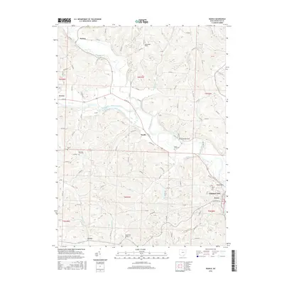
2016 Map of Randle
USGS Topo · Published 2016About this map
Coshocton and its historic riverfront neighborhood of Roscoe sit at the eastern edge of this modern survey, where the confluence of several waterways shaped the regional development. The Walhonding River is a primary landscape feature, accompanied by the visible trace of the Walhonding Canal, a reminder of the mid-19th-century transport network that once linked this interior valley to broader markets. The terrain transitions from the river bottoms to high ground like Pinfeather Ridge, with numerous small communities and crossroads such as Warsaw, Metham, and Randle scattered across the township lines. Genealogists will find a high concentration of burial sites throughout the rural landscape, including Antioch Cem, Blooming Grove Cem, and the Prairie Chapel Cem near White Womans Rock. Small water bodies like Six Mile Reservoir and Sunset Lake break up the wooded hillsides south of the main river valley.
Find a feature on this map
113 named features on this map. Tap any name to fly to it.
Don’t see what you’re looking for? This feature index may not catch every label — zoom into the map to look around manually.
Map Details
Editions of this 2016 Randle Map
This is the sole edition of this map. No revisions or reprints were ever made.
Other maps of this area

1908 · Conesville
USGS Topo · 1:62,500

1910 · Frazeysburg
USGS Topo · 1:62,500

1910 · Conesville
USGS Topo · 1:62,500

1913 · Brinkhaven
USGS Topo · 1:62,500

1913 · Coshocton
USGS Topo · 1:62,500

1915 · Brinkhaven
USGS Topo · 1:62,500

1915 · Coshocton
USGS Topo · 1:62,500

1943 · Coshocton
USGS Topo · 1:62,500

1950 · Marion
USGS Topo · 1:250,000

1951 · Canton
USGS Topo · 1:250,000