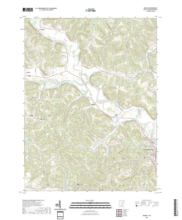
2023 Map of Randle
USGS Topo · Published 2023About this map
The Walhonding River valley in Coshocton County reveals a landscape where historic water routes and high ridges converge. The presence of the Walhonding Canal following the river's northern bank is a significant indicator of the region's 19th-century transport legacy, providing a corridor that influenced the development of Warsaw and Randle. To the north, the terrain rises sharply toward Pinfeather Ridge, while the eastern portion of the map transitions into the outskirts of Coshocton and the settlement of Roscoe. This area is particularly dense with genealogical sites, featuring numerous burial grounds including Antioch Cem, Blooming Grove Cem, and Prairie Chapel Cem. The intersection of Crooked Run and Sunset Lake further defines the topography south of the primary river valley.
Find a feature on this map
91 named features on this map. Tap any name to fly to it.
Don’t see what you’re looking for? This feature index may not catch every label — zoom into the map to look around manually.
Map Details
Editions of this 2023 Randle Map
This is the sole edition of this map. No revisions or reprints were ever made.
Other maps of this area

1908 · Conesville
USGS Topo · 1:62,500

1910 · Frazeysburg
USGS Topo · 1:62,500

1910 · Conesville
USGS Topo · 1:62,500

1913 · Brinkhaven
USGS Topo · 1:62,500

1913 · Coshocton
USGS Topo · 1:62,500

1915 · Brinkhaven
USGS Topo · 1:62,500

1915 · Coshocton
USGS Topo · 1:62,500

1943 · Coshocton
USGS Topo · 1:62,500

1950 · Marion
USGS Topo · 1:250,000

1951 · Canton
USGS Topo · 1:250,000