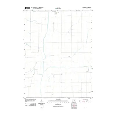
2010 Map of Randolph
USGS Topo · Published 2010About this map
Randolph anchors the northern border of this western Iowa landscape, where the town's grid meets the expansive agricultural plains of Fremont County. The topography is defined by the winding course of the West Nishnabotna River, which meanders south through the center of the sheet, flanked by several smaller tributaries including Honey Creek, Walnut Creek, and Canyon Creek. This 2010 survey illustrates the resilient rural structure of the region, where a dense network of numbered avenues and streets (such as 150 St and 320 Ave) divides the land into large parcels. Several family-named landmarks and local sites remain central to the area's identity, including the Duff Cemetery, Wagner Cemetery, and the Chamber Vaughan Cemetery to the east, while Riverside School and Mayflower School reflect the historic distribution of educational centers across the river valley.
Find a feature on this map
1 named feature on this map. Tap any name to fly to it.
Don’t see what you’re looking for? This feature index may not catch every label — zoom into the map to look around manually.
Map Details
Editions of this 2010 Randolph Map
This is the sole edition of this map. No revisions or reprints were ever made.
Other maps of this area

1939 · Farragut
USGS Topo · 1:62,500

1939 · Hamburg
USGS Topo · 1:62,500

1940 · Farragut
USGS Topo · 1:62,500

1941 · Hamburg
USGS Topo · 1:62,500

1955 · Nebraska City
USGS Topo · 1:250,000

1957 · Nebraska City
USGS Topo · 1:250,000

1957 · Randolph
USGS Topo · 1:24,000

1957 · Tabor
USGS Topo · 1:24,000

1957 · Tabor NE
USGS Topo · 1:24,000

1957 · Tabor SW
USGS Topo · 1:24,000