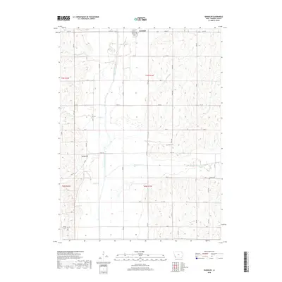
2018 Map of Randolph
USGS Topo · Published 2018About this map
Randolph anchors the northern border of this Fremont County landscape, situated just east of the meandering West Nishnabotna River. The town's grid is defined by a network of rural routes like 120th St and 325 Ave, reflecting the enduring agricultural character of this portion of Iowa. Moving south toward the smaller settlement of Anderson, the terrain is etched by several significant drainage systems including Walnut Creek and Honey Cr, which create the undulating topography between the broad river valley and the uplands to the east.
Find a feature on this map
46 named features on this map. Tap any name to fly to it.
Don’t see what you’re looking for? This feature index may not catch every label — zoom into the map to look around manually.
Map Details
Editions of this 2018 Randolph Map
This is the sole edition of this map. No revisions or reprints were ever made.
Other maps of this area

1939 · Farragut
USGS Topo · 1:62,500

1939 · Hamburg
USGS Topo · 1:62,500

1940 · Farragut
USGS Topo · 1:62,500

1941 · Hamburg
USGS Topo · 1:62,500

1955 · Nebraska City
USGS Topo · 1:250,000

1957 · Nebraska City
USGS Topo · 1:250,000

1957 · Randolph
USGS Topo · 1:24,000

1957 · Tabor
USGS Topo · 1:24,000

1957 · Tabor NE
USGS Topo · 1:24,000

1957 · Tabor SW
USGS Topo · 1:24,000