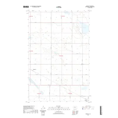
2020 Map of Rangeley
USGS Topo · Published 2020About this map
Rangeley and Guthrie anchor this North Dakota prairie landscape in McHenry County, where a grid of rural section roads like Guthrie Rd and 48th St NE organizes the township layout. The area is characterized by numerous small prairie potholes and larger water bodies such as Lauinger Lake in the north and Lake George to the east. The map records important community markers for genealogy and local history, including the Union Cem near Guthrie and the Immanuel Lutheran Cem located centrally among the fields. This survey provides a clear view of the modern agricultural footprint, showing how the land is divided across several townships including t153n r76w and t154n r77w, maintaining the traditional settlement pattern of the northern plains.
Find a feature on this map
27 named features on this map. Tap any name to fly to it.
Don’t see what you’re looking for? This feature index may not catch every label — zoom into the map to look around manually.
Map Details
Editions of this 2020 Rangeley Map
This is the sole edition of this map. No revisions or reprints were ever made.
Other maps of this area

1929 · Balfour
USGS Topo · 1:62,500

1930 · Drake
USGS Topo · 1:62,500

1950 · Karlsruhe NE
USGS Topo · 1:24,000

1954 · Minot
USGS Topo · 1:250,000

1954 · McClusky
USGS Topo · 1:250,000

1955 · Rangeley NW
USGS Topo · 1:24,000

1955 · Rangeley NE
USGS Topo · 1:24,000

1957 · Karlsruhe
USGS Topo · 1:24,000

1957 · Rangeley SE
USGS Topo · 1:24,000

1957 · Rangeley
USGS Topo · 1:24,000