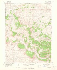
1962 Map of Rangely NE
USGS Topo · Published 1965About this map
The Rangely Oil Field dominates the southern landscape of this Rio Blanco County terrain, marking a period of intense resource extraction in Northwest Colorado. The intricate network of drainage systems, including Stinking Water Creek and Nate Spring Draw, defines a topography shaped by industrial necessity and water management. An extensive system of catchments such as Rock Shale Reservoir, Burning Mine Reservoir, and Dead Dog Reservoir illustrates the engineering required to sustain operations across the Coal Oil Basin. Along the northern reaches, the presence of various Mine and Mines labels, coupled with a prominent Pipeline, underscores the region's focus on mineral and energy wealth. The transition from the high elevations of Spooky Mountain and Blue Mountain down to the Coal Oil Rim highlights the geological stratification that made this area a focal point for mid-century energy development.
Find a feature on this map
27 named features on this map. Tap any name to fly to it.
Don’t see what you’re looking for? This feature index may not catch every label — zoom into the map to look around manually.
Map Details
Editions of this 1962 Rangely NE Map
2 editions found
Other maps of this area

1907 · Rangely
USGS Topo · 1:125,000

1910 · Rangely
USGS Topo · 1:125,000

1954 · Vernal
USGS Topo · 1:250,000

1958 · Vernal
USGS Topo · 1:250,000

1960 · Vernal
USGS Topo · 1:250,000

1962 · Lazy Y Point
USGS Topo · 1:24,000

1962 · Rangely NE
USGS Topo · 1:24,000
1962 · Rangely
USGS Topo · 1:24,000

1962 · Cactus Reservoir
USGS Topo · 1:24,000
1962 · Mellen Hill
USGS Topo · 1:24,000