
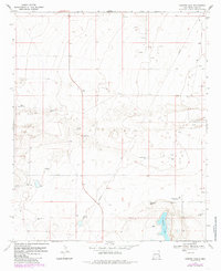
1970 Map of Ranger Lake
USGS Topo · Published 1972About this map
Ranger Lake anchors this High Plains landscape in Lea County, New Mexico, during the early 1970s. The survey reveals an environment defined by ranching and petroleum extraction, where water is the most critical resource. A network of specific named windmills, including Bull Windmill, Mixon Windmill, and North Pasture Windmill, indicates a highly managed grazing territory. The presence of Royal suggests a localized hub in an otherwise open expanse, while the distribution of Oil Wells across the northern sections shows the encroaching industrial layer of the Permian Basin. This map captures the intersection of traditional land use and modern energy development, marked by infrastructure like a Radio Tower and Gravel Pit near the lake’s edge.
Find a feature on this map
17 named features on this map. Tap any name to fly to it.
Don’t see what you’re looking for? This feature index may not catch every label — zoom into the map to look around manually.
Map Details
Editions of this 1970 Ranger Lake Map
2 editions found
Other maps of this area

1954 · Brownfield
USGS Topo · 1:250,000

1958 · Brownfield
USGS Topo · 1:250,000

1961 · Johnson Ranch
USGS Topo · 1:24,000

1962 · Brownfield
USGS Topo · 1:250,000

1970 · Walking Cane Ranch
USGS Topo · 1:24,000

1970 · Gladiola
USGS Topo · 1:24,000

1970 · Johnson Ranch
USGS Topo · 1:24,000

1970 · Simanola Valley
USGS Topo · 1:24,000

1970 · Tatum North
USGS Topo · 1:24,000

1972 · Milnesand SW
USGS Topo · 1:24,000