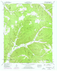
1950 Map of Ransom Stand
USGS Topo · Published 1977About this map
Ransom Stand serves as a central landmark in this 1950 topographical study, situated at the crossroads of early transport routes and family-named hollows along the Tennessee-Alabama border. The landscape is defined by the steep relief of McFalls Ridge and the deeply etched drainage systems of Horse Creek and Second Right Fork Lige Creek. The map records a rural social fabric organized around small congregations and family burial grounds, including McFalls Ch, Second Creek Church, and Centenary Cem.
Find a feature on this map
52 named features on this map. Tap any name to fly to it.
Don’t see what you’re looking for? This feature index may not catch every label — zoom into the map to look around manually.
Map Details
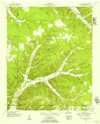
Editions of this 1950 Ransom Stand Map
2 editions found
Other maps of this area

1905 · Waynesboro
USGS Topo · 1:125,000

1911 · Iuka
USGS Topo · 1:48,000

1914 · Iuka
USGS Topo · 1:62,500

1924 · Gravelly Springs
USGS Topo · 1:48,000

1926 · Gravelly Springs
USGS Topo · 1:62,500

1935 · Wright
USGS Topo · 1:24,000

1936 · Wolf Pit Ridge
USGS Topo · 1:24,000

1936 · Waterloo
USGS Topo · 1:24,000

1936 · Threet
USGS Topo · 1:24,000

1936 · Cypress Inn
USGS Topo · 1:24,000