
1953 Map of Rapid City
USGS Topo · Published 1964About this map
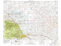
Rapid City serves as the gateway to the western South Dakota plains and the eastern flank of the Black Hills National Forest in this mid-century portrait. The landscape is defined by the contrast between the densely wooded heights of Oyster Mountain and Lookout Peak and the open rangelands to the east, where the Belle Fourche River and Cheyenne River converge. The Cold War footprint is prominent here, shown through the sprawling grounds of Ellsworth Air Force Base and the Rapid City Air Force Base, anchoring the region's strategic importance during the 1950s.
Find a feature on this map
102 named features on this map. Tap any name to fly to it.
Don’t see what you’re looking for? This feature index may not catch every label — zoom into the map to look around manually.
Map Details
Editions of this 1953 Rapid City Map
3 editions found
Other maps of this area

1893 · Rapid
USGS Topo · 1:125,000

1894 · Deadwood
USGS Topo · 1:125,000

1894 · Hermosa
USGS Topo · 1:125,000

1896 · Harney Peak
USGS Topo · 1:125,000

1898 · Sundance
USGS Topo · 1:125,000

1898 · Rapid
USGS Topo · 1:125,000

1899 · Sturgis
USGS Topo · 1:62,500

1899 · Newcastle
USGS Topo · 1:125,000

1900 · Spearfish
USGS Topo · 1:62,500

1901 · Hermosa
USGS Topo · 1:125,000