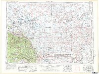
1953 Map of Rapid City
USGS Topo · Published 1978About this map
The Black Hills National Forest dominates the western landscape of this mid-century survey, anchoring a region defined by high peaks and strategic military installations. From the dense cluster of mining towns like Lead and Galena to the expansive plains of the Cheyenne River basin, the map illustrates the 1950s infrastructure of western South Dakota. A significant highlight is Ellsworth Air Force Base and the Fort Meade Veterans Administration Hospital, marking the area's importance as a federal and military hub.
Find a feature on this map
86 named features on this map. Tap any name to fly to it.
Don’t see what you’re looking for? This feature index may not catch every label — zoom into the map to look around manually.
Map Details
Editions of this 1953 Rapid City Map
3 editions found

Other maps of this area

1893 · Rapid
USGS Topo · 1:125,000

1894 · Deadwood
USGS Topo · 1:125,000

1894 · Hermosa
USGS Topo · 1:125,000

1896 · Harney Peak
USGS Topo · 1:125,000

1898 · Sundance
USGS Topo · 1:125,000

1898 · Rapid
USGS Topo · 1:125,000

1899 · Sturgis
USGS Topo · 1:62,500

1899 · Newcastle
USGS Topo · 1:125,000

1900 · Spearfish
USGS Topo · 1:62,500

1901 · Hermosa
USGS Topo · 1:125,000