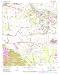
1972 Map of Rapides
USGS Topo · Published 1992About this map
England Air Force Base dominates the central landscape of this Rapides Parish region, showing a significant military presence alongside the evolving urban footprint of Alexandria. The 1972 data, updated in the early 1990s, captures the transition of rural bayou lands into specialized facilities like the Central Louisiana State Hospital and various suburban extensions. To the west, the elevation rises into the Kisatchie National Forest and the shores of Kincaid Reservoir, providing a stark contrast to the alluvial plains of the Red River. Local history is preserved through numerous small communities and landmarks like Alfalfa, Rapides, and Lamothe Bridge. A dense network of smaller waterways, including Bayou Rapides and Persimmon Bayou, reflects the complex drainage of the lowland south of the river levee, while sites like St Matthews Ch and Newlight Cem mark long-established social centers.
Find a feature on this map
49 named features on this map. Tap any name to fly to it.
Don’t see what you’re looking for? This feature index may not catch every label — zoom into the map to look around manually.
Map Details
Editions of this 1972 Rapides Map
3 editions found
Other maps of this area

1932 · Boyce NE
USGS Topo · 1:31,680

1932 · Boyce SW
USGS Topo · 1:31,680

1935 · Lecompte
USGS Topo · 1:62,500

1941 · Alexandria
USGS Topo · 1:62,500

1941 · Boyce
USGS Topo · 1:62,500

1945 · Boyce SE
USGS Topo · 1:31,680

1949 · Boyce NW
USGS Topo · 1:31,680

1949 · Boyce SE
USGS Topo · 1:31,680

1953 · Alexandria
USGS Topo · 1:250,000

1955 · Alexandria
USGS Topo · 1:250,000