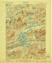
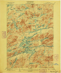
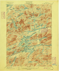
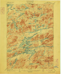
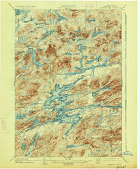
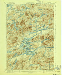
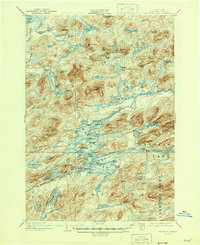
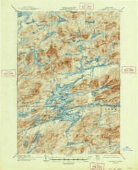
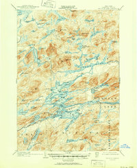
1903 Map of Raquette Lake
USGS Topo · Published 1921About this map
Whitney's Little Forked Lake and the massive Brandreth Lake anchor this 1899 survey of the Adirondack interior. The landscape is a dense network of water and high peaks, where early tourism and private preserves began to shape the region's character. A notable Steamboat Route cuts through the central waters, linking remote points like Pine Knot Pt. and indicating the primary mode of travel before established road networks. The map details numerous named summits such as Salmon Lake Mt. and Niggerhead Mt. alongside smaller, secluded bodies of water like Antediluvian Pond and Flatfish Pond. The inclusion of Fish Camp and various unnamed camps suggests the era's reliance on seasonal outposts for hunting and resource management within Hamilton County.
Find a feature on this map
113 named features on this map. Tap any name to fly to it.
Don’t see what you’re looking for? This feature index may not catch every label — zoom into the map to look around manually.
Map Details
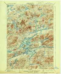
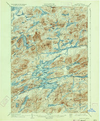
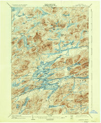
Editions of this 1903 Raquette Lake Map
13 editions found

1903 edition
16.6 x 20.1 inches
1906 edition
16.7 x 20.1 inches
1909 edition
16.6 x 20 inches
1912 edition
16.6 x 20 inches
1921 edition
16.6 x 20.1 inches
1926 edition
16.6 x 20.1 inches
1930 edition
16.6 x 20.1 inches
1933 edition
16.5 x 19.9 inches
1936 edition
16.6 x 20.1 inches
1940 edition
16.6 x 20.1 inches
1946 edition
17 x 20.9 inches
1947 edition
17.1 x 20.9 inches
1951 edition
17 x 20.9 inches
Other maps of this area

1899 · Indian Lake
USGS Topo · 1:62,500

1900 · Canada Lake
USGS Topo · 1:62,500

1901 · Old Forge
USGS Topo · 1:62,500

1902 · Indian Lake
USGS Topo · 1:62,500

1903 · Big Moose
USGS Topo · 1:62,500

1903 · West Canada Lakes
USGS Topo · 1:62,500
1903 · Raquette Lake
USGS Topo · 1:62,500

1903 · Blue Mountain
USGS Topo · 1:62,500

1904 · Long Lake
USGS Topo · 1:62,500

1907 · Tupper Lake
USGS Topo · 1:62,500