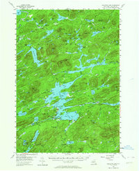
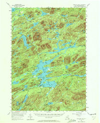
1954 Map of Raquette Lake
USGS Topo · Published 1964About this map
Raquette Lake serves as the focal point of this mid-century survey of the central Adirondacks, capturing a landscape defined by extensive water systems and early recreational development. The settlement at Raquette Lake includes local institutions like the Raquette Lake Sch and specialized religious architecture such as St Williams Ch and St Hubert Ch, reflecting the area's growth as a seasonal retreat. An Old Railroad Grade cutting through the northern woods near Salmon Lake Mtn traces the remnants of earlier industrial access, while numerous portages like the Canoe Carry highlight the traditional movement between Forked Lake and the Raquette River. The map meticulously details the surrounding peaks, including Niggerhead Mtn and Pilgrim Mtn, and identifies early public recreational spaces such as the Golden Beach Campsite on the southern shores.
Find a feature on this map
132 named features on this map. Tap any name to fly to it.
Don’t see what you’re looking for? This feature index may not catch every label — zoom into the map to look around manually.
Map Details
Editions of this 1954 Raquette Lake Map
5 editions found
Other maps of this area

1899 · Indian Lake
USGS Topo · 1:62,500

1900 · Canada Lake
USGS Topo · 1:62,500

1901 · Old Forge
USGS Topo · 1:62,500

1902 · Indian Lake
USGS Topo · 1:62,500

1903 · Big Moose
USGS Topo · 1:62,500

1903 · West Canada Lakes
USGS Topo · 1:62,500

1903 · Raquette Lake
USGS Topo · 1:62,500

1903 · Blue Mountain
USGS Topo · 1:62,500

1904 · Long Lake
USGS Topo · 1:62,500

1907 · Tupper Lake
USGS Topo · 1:62,500