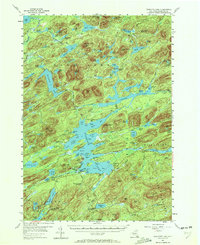
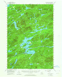
1954 Map of Raquette Lake
USGS Topo · Published 1972About this map
The Adirondack State Park dominates this mid-century survey, revealing a landscape defined by expansive water bodies and remote camps. Raquette Lake sits at the heart of the sheet, surrounded by intricate shorelines such as Antlers Point, Tioga Point, and Woods Point. The presence of the Railroad Grade near Rock Pond and the Canoe Carry near Forked Lake indicates the area's historical reliance on seasonal transport and recreational tourism. Small enclaves like St Williams and Deerland Camp represent the pocketed human presence within the deep forest.
Find a feature on this map
123 named features on this map. Tap any name to fly to it.
Don’t see what you’re looking for? This feature index may not catch every label — zoom into the map to look around manually.
Map Details
Editions of this 1954 Raquette Lake Map
5 editions found
Other maps of this area

1899 · Indian Lake
USGS Topo · 1:62,500

1900 · Canada Lake
USGS Topo · 1:62,500

1901 · Old Forge
USGS Topo · 1:62,500

1902 · Indian Lake
USGS Topo · 1:62,500

1903 · Big Moose
USGS Topo · 1:62,500

1903 · West Canada Lakes
USGS Topo · 1:62,500

1903 · Raquette Lake
USGS Topo · 1:62,500

1903 · Blue Mountain
USGS Topo · 1:62,500

1904 · Long Lake
USGS Topo · 1:62,500

1907 · Tupper Lake
USGS Topo · 1:62,500