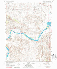
1965 Map of Rasmussen Hollow
USGS Topo · Published 1987About this map
Ashley Valley and the winding course of the Green River define this corner of Uintah County, Utah. The landscape is marked by the industrial footprints of the mid-1960s, specifically an active Oil Field and numerous exploratory Drill Holes that signal the region's energy development. Along the northern edge, Ashley Creek feeds into the valley near a Gaging Station and substation, while the rugged southern terrain is carved by complex drainages like Rasmussen Hollow and Walker Hollow.
Find a feature on this map
19 named features on this map. Tap any name to fly to it.
Don’t see what you’re looking for? This feature index may not catch every label — zoom into the map to look around manually.
Map Details
Editions of this 1965 Rasmussen Hollow Map
2 editions found
Other maps of this area

1885 · Ashley
USGS Topo · 1:250,000

1907 · Jensen
USGS Topo · 1:125,000

1910 · Jensen
USGS Topo · 1:125,000

1917 · Vernal
USGS Topo · 1:125,000

1954 · Vernal
USGS Topo · 1:250,000

1958 · Vernal
USGS Topo · 1:250,000

1960 · Vernal
USGS Topo · 1:250,000

1964 · Vernal NE
USGS Topo · 1:24,000

1964 · Brennan Basin
USGS Topo · 1:24,000
1964 · Vernal SE
USGS Topo · 1:24,000