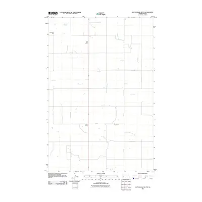
2011 Map of Rattlesnake Butte
USGS Topo · Published 2011About this map
Saint Marys Cemetery and Saint Boniface Cemetery stand as quiet landmarks within this rural landscape of Billings County. This prairie terrain is defined by the winding course of the Green River and the northern flow of Spring Creek. The map shows a precise grid of local section roads, such as Franks Creek Rd and 26st St, which provide access to scattered homesteads and agricultural tracts across the North Dakota badlands. The prominent elevation of Rattlesnake Butte rises above the surrounding plains, serving as a primary navigational point for the region. To the northwest, Kordonowy Dam marks a point of water management on the upper reaches of the creek system. The layout reflects the enduring pattern of High Plains settlement, where small cemeteries and isolated landforms remain the primary markers of community history and geography.
Find a feature on this map
19 named features on this map. Tap any name to fly to it.
Don’t see what you’re looking for? This feature index may not catch every label — zoom into the map to look around manually.
Map Details
Editions of this 2011 Rattlesnake Butte Map
This is the sole edition of this map. No revisions or reprints were ever made.
Other maps of this area

1953 · Dickinson
USGS Topo · 1:250,000

1953 · Watford City
USGS Topo · 1:250,000

1957 · Dickinson
USGS Topo · 1:250,000

1957 · Watford City
USGS Topo · 1:250,000

1962 · Fryburg NE
USGS Topo · 1:24,000

1962 · Belfield NE
USGS Topo · 1:24,000

1962 · Belfield
USGS Topo · 1:24,000

1963 · Fairfield SE
USGS Topo · 1:24,000

1963 · Fairfield
USGS Topo · 1:24,000

1963 · Gorham SE
USGS Topo · 1:24,000