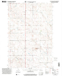
1997 Map of Rattlesnake Butte
USGS Topo · Published 2001About this map
The Green River and the South Fork Green River converge in this Billings County landscape, defining a region where rural infrastructure follows the natural drainage of the Badlands. In the late 20th century, the presence of a Gas Plant and numerous industrial sites like the Scoria Pit and various gravel pits indicates a landscape deeply tied to resource extraction. For those researching local heritage, the map identifies several rural educational and religious hubs that served the surrounding farmstead community, including St Demetrius Ch, Klym Sch, and Schaff Sch. The prominent landmark of Rattlesnake Butte stands as a central navigational point amidst the section lines, while several burial grounds, such as St Marys Cem and St Boniface Cem, provide essential data points for genealogical study in this portion of North Dakota.
Find a feature on this map
16 named features on this map. Tap any name to fly to it.
Don’t see what you’re looking for? This feature index may not catch every label — zoom into the map to look around manually.
Map Details
Editions of this 1997 Rattlesnake Butte Map
This is the sole edition of this map. No revisions or reprints were ever made.
Other maps of this area

1953 · Dickinson
USGS Topo · 1:250,000

1953 · Watford City
USGS Topo · 1:250,000

1957 · Dickinson
USGS Topo · 1:250,000

1957 · Watford City
USGS Topo · 1:250,000

1962 · Fryburg NE
USGS Topo · 1:24,000

1962 · Belfield NE
USGS Topo · 1:24,000

1962 · Belfield
USGS Topo · 1:24,000

1963 · Fairfield SE
USGS Topo · 1:24,000

1963 · Fairfield
USGS Topo · 1:24,000

1963 · Gorham SE
USGS Topo · 1:24,000