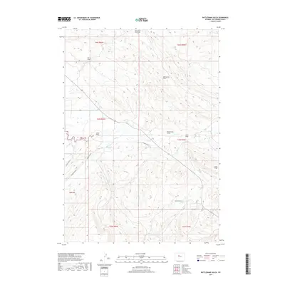
2017 Map of Rattlesnake Gulch
USGS Topo · Published 2017About this map
Rush Reservoir and the winding course of Owl Cr anchor this high-plains landscape in Hot Springs County. The terrain is defined by a series of drainage systems, including the long descent of Meeteetse Draw and the prominent Cedar Ridge to the east. Transportation through this arid section relies on historic routes such as Missouri Flat Rd and Red Canyon Rd, which navigate the complex topography of draws and gulches. The map reveals a remote ranching and grazing environment where water sources like Mud Cr and the eponymous Rattlesnake Gulch have historically dictated movement and land use. Small-scale developments appear near the intersections of Helen St and Nostrum St, providing a localized view of 21st-century rural infrastructure in the Bighorn Basin area.
Find a feature on this map
25 named features on this map. Tap any name to fly to it.
Don’t see what you’re looking for? This feature index may not catch every label — zoom into the map to look around manually.
Map Details
Editions of this 2017 Rattlesnake Gulch Map
This is the sole edition of this map. No revisions or reprints were ever made.
Other maps of this area

1914 · Blue Mesa
USGS Topo · 1:62,500

1916 · Blue Mesa
USGS Topo · 1:62,500

1945 · Kirby
USGS Topo · 1:62,500

1946 · Kirby
USGS Topo · 1:62,500

1955 · Thermopolis
USGS Topo · 1:250,000

1958 · Thermopolis
USGS Topo · 1:250,000
1960 · Wedding Of The Waters
USGS Topo · 1:24,000

1960 · Thermopolis
USGS Topo · 1:24,000

1962 · Thermopolis
USGS Topo · 1:250,000
1965 · Potato Butte
USGS Topo · 1:24,000