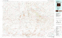
1981 Map of Rattlesnake Hills
USGS Topo · Published 1981About this map
Rattlesnake Hills and the Granite Mountains dominate this high-desert landscape across the Fremont and Natrona County line. The terrain is defined by the massive drainage systems of the Sweetwater River and the South Fork Powder River, separated by the prominent Beaver Divide. This 1981 compilation, drawing on data back to the 1950s, highlights the isolation of central Wyoming, where the industrial presence at Lucky Mac Camp and scattered mines contrast with the natural expanses of the Pathfinder National Wildlife Refuge. Regional hydrology is notably diverse, ranging from the vast Pathfinder Reservoir to seasonal features like Buffalo Wallows, The Dry Lake, and Soda Lakes. Distinctive basins such as Ervay Basin and Keester Basin sit tucked between ridges like Signor Ridge, illustrating the complex geological folds of the Wyoming interior.
Find a feature on this map
27 named features on this map. Tap any name to fly to it.
Don’t see what you’re looking for? This feature index may not catch every label — zoom into the map to look around manually.
Map Details
Editions of this 1981 Rattlesnake Hills Map
This is the sole edition of this map. No revisions or reprints were ever made.
Other maps of this area

1951 · Savage Peak
USGS Topo · 1:24,000

1951 · Pine Mountain SW
USGS Topo · 1:24,000

1951 · Benton Basin SW
USGS Topo · 1:24,000

1951 · Fuller Reservoir
USGS Topo · 1:24,000

1951 · Bucklin Reservoirs
USGS Topo · 1:24,000

1951 · Soap Holes
USGS Topo · 1:24,000

1951 · Pathfinder Reservoir NW
USGS Topo · 1:24,000

1951 · Crooks Creek NE
USGS Topo · 1:24,000

1951 · Independence Rock
USGS Topo · 1:24,000

1951 · Stampede Meadow
USGS Topo · 1:24,000