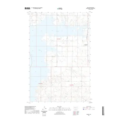
2020 Map of Raub NW
USGS Topo · Published 2020About this map
Lake Sakakawea dominates this North Dakota landscape, formed by the impoundment of the Missouri River. The shoreline is deeply indented by geographic features such as Deepwater Creek Bay and Arikara Bay, reflecting the drowned coulees and drainages typical of this Missouri Plateau region. Inland from the water, the terrain is defined by the winding course of Charging Cr and a network of section-line roads, including 23rd St NW and 75th Ave NW.
Find a feature on this map
20 named features on this map. Tap any name to fly to it.
Don’t see what you’re looking for? This feature index may not catch every label — zoom into the map to look around manually.
Map Details
Editions of this 2020 Raub NW Map
This is the sole edition of this map. No revisions or reprints were ever made.
Other maps of this area

1953 · Watford City
USGS Topo · 1:250,000

1957 · Watford City
USGS Topo · 1:250,000

1967 · Watford City
USGS Topo · 1:250,000

1967 · Raub SE
USGS Topo · 1:24,000

1967 · Raub NW
USGS Topo · 1:24,000

1967 · Raub
USGS Topo · 1:24,000

1967 · Twin Buttes
USGS Topo · 1:24,000
1967 · Parshall SE
USGS Topo · 1:24,000

1967 · Parshall SW
USGS Topo · 1:24,000

1967 · New Town SE
USGS Topo · 1:24,000