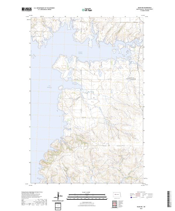
2024 Map of Raub NW
USGS Topo · Published 2024About this map
Lake Sakakawea dominates this portion of McLean County, where the reservoir's fingers reach into the prairie to form Deepwater Creek Bay and Arikara Bay. The landscape is defined by the transition from the high, dissected plateaus of the Missouri Coteau down to the flooded river valley. In the eastern uplands, the Susan Webb Hall Memorial Congregational Church and its accompanying cemetery stand as significant local landmarks near the intersection of 20th St NW and 72nd Ave NW. To the south, the terrain becomes more broken as Charging Creek meanders toward the water, crossed by BIA Rd 904. The grid of section lines and gravel roads, including 75th Ave NW, illustrates the enduring structure of North Dakota's rural land survey system in the modern era.
Find a feature on this map
18 named features on this map. Tap any name to fly to it.
Don’t see what you’re looking for? This feature index may not catch every label — zoom into the map to look around manually.
Map Details
Editions of this 2024 Raub NW Map
This is the sole edition of this map. No revisions or reprints were ever made.
Other maps of this area

1953 · Watford City
USGS Topo · 1:250,000

1957 · Watford City
USGS Topo · 1:250,000

1967 · Watford City
USGS Topo · 1:250,000

1967 · Raub SE
USGS Topo · 1:24,000

1967 · Raub NW
USGS Topo · 1:24,000

1967 · Raub
USGS Topo · 1:24,000

1967 · Twin Buttes
USGS Topo · 1:24,000
1967 · Parshall SE
USGS Topo · 1:24,000

1967 · Parshall SW
USGS Topo · 1:24,000

1967 · New Town SE
USGS Topo · 1:24,000