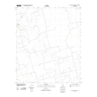
2010 Map of Raven Creek North
USGS Topo · Published 2010About this map
Sylvester serves as the primary settlement in this portion of Jones County, situated near the intersection of FM 57 and Co Rd 110. The landscape is defined by the winding course of the Clear Fork, which meanders across the center of the sheet, joined by several significant tributaries. Water resources are central to the terrain, with China Creek and East China Creek draining the western reaches, while Dry Creek and Raven Creek define the southeastern quadrant.
Find a feature on this map
23 named features on this map. Tap any name to fly to it.
Don’t see what you’re looking for? This feature index may not catch every label — zoom into the map to look around manually.
Map Details
Editions of this 2010 Raven Creek North Map
This is the sole edition of this map. No revisions or reprints were ever made.
Other maps of this area

1893 · Roby
USGS Topo · 1:125,000

1931 · Rotan
USGS Topo · 1:62,500

1954 · Big Spring
USGS Topo · 1:250,000

1957 · Noodle
USGS Topo · 1:62,500

1958 · Big Spring
USGS Topo · 1:250,000
1965 · Neinda
USGS Topo · 1:24,000

1965 · McCaulley
USGS Topo · 1:24,000

1969 · Eskota
USGS Topo · 1:24,000
1969 · Longworth
USGS Topo · 1:24,000
1969 · Royston
USGS Topo · 1:24,000